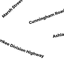
5 ASHLAND PL
Owner Information
AARONS MARY D
5 ASHLAND PL
GLOUCESTER, MA 01930


Property Details
5 ASHLAND PL is classified as a Single Family Residential (Colonial).
The primary structure on this property was built in 1800. There are 2,627ft2 of built area within this property. There is 1,308ft2 of residential/living space within this property.
5 ASHLAND PL is valued at $476,100. The land is valued at $145,000 and the structures are valued at $321,700. There is an additional valuation of $9,400 on this property.
This property is in Zone R-10. Confirm with local Zoning Board authorities to ensure there are no overlays or other easements on this property.
The most recent deed for 5 ASHLAND PL is recorded at the local registrar in Book 16214, Page 80. 5 ASHLAND PL was last sold on Monday, February 28, 2000 for $220,000.
Assessment data from fiscal year 2022.
Flood Data
According to the FEMA National Flood Hazard Layer, this property does not appear to be in a flood zone. It may also be in an area not yet reviewed. Nonetheless, confirm this information prior to taking any action.
To view the flood hazards around this property, create a FEMA "Firmette" Map of the area around 5 ASHLAND PL.
Broadband Internet Providers
| Provider | Type | Bandwidth (mbps) | |
|---|---|---|---|
| VSAT Systems, LLC. | Satellite | 2 | 1 |
| Viasat Inc | Satellite | 100 | 3 |
| Verizon New England Inc. | DSL | 15 | 1 |
| Comcast | Cable | 1000 | 35 |
| HughesNet | Satellite | 25 | 3 |
| GCI Communication Corp. | Satellite | 0 | 0 |
| T-Mobile | Fixed Wireless | 25 | 3 |
Broadband service provider data from December 2020.
Adjacent Properties
- 4 CUNNINGHAM RD
Single Family Residential owned by VERGE WARREN E & JEANNE - 6 CUNNINGHAM RD
Single Family Residential owned by FERAZZI LOUISE C - 8 CUNNINGHAM RD
Single Family Residential owned by GOVE JASON K & ALISON G - 7 ASHLAND PL
Single Family Residential owned by CURLEY BRIAN & CURLEY MARIE F - 3 ASHLAND PL
Two-Family Residential owned by PORPER ROBERT B JR & JILL A